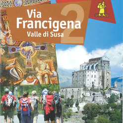
Via Francigena


Stretching back to ancient times the Susa Valley has been a central point for connecting Italy with France, through the Monginevro and Moncenisio passes.
The medieval period endorsed its leading role as a gateway between the Italian peninsula and the rest of Europe for merchants, armies, aristocrats, men of Church and pilgrims who were aiming to reach Rome, the epicentre of Christianity, or Santiago de Compostela, the ancient religious destination.
Already in 333 AD, the Moniginevro Pass was crossed by the anonymous author of Itinerarium burdigalense (the oldest description of a Christian pilgrimage route) for reaching the Holy Land: precise notes were made of the mansio and the statio in Susa Valley, some of which are now important archaeological sites.
Starting from the early Middle Ages, the Moncenisio Pass became one of the nerve centres of the European political scene with the first arrival in Italy of Charlemagne in 773 for the Battaglia delle Chiuse against the Longobards, and the marriage of the Comitissa Adelaide Manfredi with Oddone di Moriana-Savoia in 1046, which resulted in the Savoy dynasty entering Piedmont and, thus, Italy.
The intense flow of people along the Via Francigena circulated ideas and generated a constant exchange of knowledge, languages and religion which helped nurture a European cultural energy in the valley: monasteries of international renown were built, such as the Abbey of Novalesa and the Sacra di San Michele, other places of worship with a more local feel such as the Cripta di Celle, chapels, as well as town centres home to markets or places of transit and the mandatory tolls such as Susa, Bussoleno, Avigliana and Oulx.
Along the route were created hospitali, xenodochia, inns and hotels such as the Ospedale di Passo del Moncenisio (founded between 814 and 825 AD), the inns of Novalesa and Bussoleno or places of assistance such as the Precettoria di Sant'Antonio at Ranverso and Hotel dieu at Salbertrand, known for the treatments against ergotism.
Fortified castles, strongholds and palaces, marking out many of the Susa Valley villages – Oulx, Chiomonte, Susa,San Giorio, Chianocco, Bruzolo – now reveal the widespread territorial control held and also the aristocratic power along the valley, relating to the economic and commercial importance that the route acquired over time.
These days, going along the Via Francigena in the Susa Valley means a journey for discovering art, nature and culture, where also the cuisine, the typical seasonal products, the fetes and fairs of ancient tradition are still a living expression of the territory's identity.
It is through this varied and authentic panorama that the route meanders for over 170km with two historical variants, starting from Moncenisio and Monginevro towards the valley floor and on towards Turin: by taking the Via Francigena in the Susa Valley, the many pilgrims and hikers are offered the chance for once again savouring the spirit of this land and for reliving, by means of gentle tourism that revives the spirit, mind and body, a unique cultural mosaic.
for further details see:
http://www.turismotorino.org/viafrancigena/IT/home
Milestones
- development: 24,4 km
- run time: 7 ore
- ascending drop: 405 m
- discending drop: 1995 m
- difficulty: Escursionistico
- starting: Colle del Moncenisio 2097 m slm
- arrival: Susa 506 m slm
Known in the past as Ferrera, it developed due to its strategic role as an obligatory stop along the way: the living museum route and the Parish Church of San Giorgio provide information on its history relating to the pass.
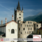
San Giusto Cathedral and the imposing bell-tower with its slender octagonal spire are the result of various styles of architecture layering over the years, since 1029 – when the Benedictine abbey was founded – to the Gothic and neo-Gothic additions between the 13th and 19th centuries. Stratified decorative series can be seen outside, such as L’entrata di Cristo in Gerusalemme (15th century, attributed to Serra di Pinerolo) and the Medaglioni dei Santi e profeti; precious paintings, richly decorated altars and the 14th century wood choir stalls adorn the interior.
A short distance away there was the Priory of Santa Maria Maggiore, the oldest baptismal church of the Susa Valley, of which remains the Romanesque bell-tower; other testimonies of the Susa Valley’s religious heritage are the Church and Convent of San Francesco which, according to tradition, was founded by St Francis of Assisi when he passed through in 1214. On the left bank of the Dora Riparia there is the baroque Church of Madonna della Pace, or the Church del Ponte, whose adjacent rooms house the Diocesan Museum of Sacred Art with important collections; the Tesoro della Cattedrale di San Giusto, the Tesoro della Chiesa del Ponte, the Oreficerie, the Statuaria and the Tessili.
- development: 18,4 km
- run time: 7 ore
- ascending drop: 785 m
- discending drop: 1082 m
- difficulty: Escursionistico
- starting: Colle del Monginevro 1793 m slm
- arrival: Oulx 1082 m slm
Colle del Monginevro - Claviere (2,4 km)
The Monginevro Pass, mons Matronae for the ancient Romans, is the historical pass from France to Italy: having left Montgenèvre, from the milestone that says 2010km to Santiago de Compostela and 914km to Rome, you enter the Susa Valley, crossing Clavière, a tourist and skiing centre in the Vialattea ski area dominated by the soaring Mount Chaberton.
Claviere - Cesana torinese (5,1 km)
The marked path goes along the beautiful Gole di San Gervasio (which can also be crossed by taking the exciting Tibetan Rope Bridge), following the course of the river through to the asphalted road just above Cesana Torinese. You go through the centre of this Alpine hamlet up to the parish church of San Giovanni Battista which towers over the village and is characterised by a majestic bell-tower in Romanesque-Dauphin style and, inside, by a richly decorated wooden coffered ceiling of 1678. The route continues along a dirt road, running parallel and higher up than the state road, and takes to the picturesque villages of Mollieres and Solomiac.
Cesana torinese - Oulx (13,4 km)
Going for a short way along the state road, from the turnoff for Fenils, leads to another dirt road which heads towards the fork of Amazas. From here, avoiding the motorway crossing, you go up towards the village of San Marco and then, descending, you reach the Parish Church of Santa Maria Assunta which, by its Torre Delfinale (15th century), towers over the town of Oulx. At one time the location for the Prevostura (Provostship) of San Lorenzo (11th century), this hamlet became one of the main sites of the Escarton, an independent form of territory administration, still recalled in the Fiera Franca, the oldest free fair in the Susa Valley, granted in 1494 by the King of France as recompense for the damage incurred by the transit of armies.
Oulx - Salbertrand (7,2 km)
The route continues along the tarred road. Going past the village of Gad you then follow the directions for the Sentiero dei Franchi (a mountain hike that leads to the Sacra di San Michele) up to the deviation for Salbertrand: this is home to the Gran Bosco Natural Park, one of the largest white spruce woods in Europe, and to the Colombano Romean Living Museum which includes as one of its tours a viewing of the splendid 16th century frescoes in the Parish Church of San Giovanni Battista and the Chapel of San Cristoforo in the village of Oulme.
Salbertrand - Exilles (6,2 km)
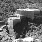
Continuing along the Sentiero dei Franchi, you reach Sapè, from which you turn to descend towards Exilles, a hamlet featuring intact Alpine architecture of stone and wood, and dominated by the impressive Fort Exilles (12th century). In the central square there is the Romanesque bell-tower and the Parish Church of San Pietro Apostolo which has a richly decorated high altar of 1681. Also the small Chapel of San Rocco, just at the exit of the town, is of interest, possibly the result of renovating an earlier building.
Exilles - Chiomonte (7,5 km)
The route continues around the Fort, partly going down the eastern access ramp, and reaches the ancient path that leads to the crossing over the Dora Riparia. In the distance, on the left, can be seen the old bridge and the new high bridge that cross the Gorges of the Dora: shortly after, the trail turns back on itself, going along the left bank of the river. This is followed by a flat section and then, descending, a picturesque area through the terraces of Avanà vines, a highly appreciated native wine recently rediscovered: today this stretch is characterised by the bold contraposition of an almost extinct civilisation with the high flyovers of the modern Frejus motorway.
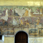
Chiomonte is the next stage on the route, once the summer residence of the Bishop of Pinerolo: the old town centre is an exceptional gem of courtyards, porticoes, alleys and ancient aristocratic palazzos such as Casa Ronsil and Palazzo Levis, home to the Pinacoteca Civica (art gallery); the Chapel of Santa Caterina, formerly dedicated to John the Baptist, is all that remains of the Hierosolymitan hospital: its interiors decorated in the Baroque period, there are fragments of 14th century frescos while the outside has a decoration of blind arcades and a 13th century poly-lobed portal. The Parish Church of Santa Maria Assunta, flanked by a majestic bell-tower in Romanesque-Dauphin style, has valuable wood furnishings typical to Alpine baroque such as the choir-stalls and the pastoral seat, works by Jacques Jesse of Embrun, the main door by Eymon Lord, and the retable (altarpiece) of twisted columns on the altar of the Rosario (1682) by Cheffrey Faure. Along the main street there is a beautiful stone fountain dating back to 1544 with four jets of highly refreshing water: travellers should get supplies here for continuing their journey since there will be no other chance for quenching their thirst until Susa.
Chiomonte - Susa (7,2 km)
On leaving Chiomonte, the route runs beside the main road for about 800m along a protected path, and is then left at the signpost “Strada del Plans”, going to the left along dirt roads and trails, through meadows and woods towards the deep ravine of the Gorge della Dora, which can be glimpsed through the thick vegetation. The route is in constant descent, apart from an occasional short rise, and goes close to the cliffs of the Gorge above which, on the opposite side, can be seen the villages of Giaglione silhouetted against the sky and the Rocciamelone mountain.
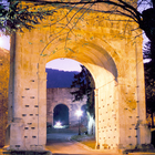
At this point, having crossed the territory of Gravere, the trail gently descends into the woods, revealing here and there the paved road of the probable Via delle Gallie that leads to the incomparable entry into Susa through the elegant Augustan Arch (8BC), next to the remains of the Roman aqueduct (3rd century AD) built on the rocks of a Celtic altar. In this area there is a fountain with exceptionally cold water, even in the summer, and is an important refilling point for those taking the route towards France. A little further down stands the majestic Porta Savoia on the medieval walls to the west of the city, from where started the road towards the “Gaul lands”.
- development: 27,2 km
- run time: 10 ore
- ascending drop: 537 m
- discending drop: 665 m
- difficulty: Escursionistico
- starting: Susa 500 m slm
- arrival: Chiusa San Michele 378 m slm
Lasciate alle spalle le vestigia romane e medioevali di Susa dalla stazione ferroviaria si procede in direzione di Urbiano, frazione di Mompantero: antico insediamento testimoniato dai resti di un acquedotto romano, è noto per il rito ancestrale del 31 gennaio detto Fora l’ours!, durante il quale si celebra l’imminente uscita dall’inverno con la cattura dell’orso risvegliatosi dal letargo. Il percorso prosegue verso San Giuliano e Chiodo, frazioni di Susa, attraversando cascine e prati coltivati, sino a raggiungere le prime abitazioni di Foresto -Bussoleno e la Cappella della Madonna delle Grazie o della Posta, con affreschi quattrocentesci sulla vita della Vergine, attribuiti al tolosano Anthoyne de Lhonye. Una breve deviazione conduce alla Riserva Naturale dell’Orrido di Foresto, una suggestiva gorgia scavata dal millenario passaggio dell’acqua. Proseguendo lungo l’Antica Strada di Foresto si oltrepassa la stazione ferroviaria e si raggiunge il ponte sulla Dora Riparia che immette nel borgo medioevale dove si incontrano alcune abitazioni che ispirarono il D’Andrade per il Borgo Medioevale di Torino: Palazzo Allais, Casa Amprimo, detta anche Locanda della Croce Bianca, e Casa Aschieri. La Parrocchiale di Santa Maria Assunta (XII sec.), affiancata dal campanile romanico testimonia la riedificazione settecentesca a opera dell’architetto lorense De Willencourt.
Lasciando l’abitato di Bussoleno, si attraversa la SS 24 in corrispondenza dell’ampia rotonda nei pressi del cimitero, per proseguire sulla via Rivoiretta, che risale gradualmente in direzione sud est attraverso l’ampia fascia di coltivi che si frappone tra la piana della Dora e il massiccio dell’Orsiera.
Giunti ad incrociare la galleria autostradale, si svolta a sinistra su una sterrata che segue il percorso della galleria; dopo 300 m si gira a destra su strada Roncaglie, che si percorre superando in sequenza le borgate Roncaglie, Balma, Martinetti-Viglietti. Attraversata quest’ultima si prosegue , a mezza costa, per circa 2,5 km su sterrato in mezzo al bosco di castagneti dove si coltivano i pregiati Marroni IGP Valsusa. Il cammino si sovrappone al Sentiero della Pietra e del Castagno ed è anche parte del tracciato della Via Francigena Marathon. Al termine del bosco si costeggiano ampi coltivi e fronti di cava di gneiss, una delle principali attività delle comunità locali fino a 40 anni fa, fino ad incrociare la strada che da Villar Focchiardo conduce alla Borgata Banda. Qui un’antica abbazia certosina, grangia dipendente della più nota Certosa di Montebendetto (XIV sec.), sorprende con i suoi due chiostri, ora in restauro. Poco prima di quest’ultima si prende a sx la strada del Parore che in ripida discesa raggiunge il torrente Gravio (prestare attenzione alla difficoltà della salita se fatta in senso opposto ovvero in direzione di Santiago), attraversato il quale si giunge a Villar Focchiardo con la sua imponente e barocca parrocchiale di Santa Maria Assunta.
Da Villar Focchiardo, si oltrepassa la frazione Comba e si segue l’Antica Strada di Francia fino a Sant’Antonino di Susa. La piazza principale è dominata dall’imponente facciata della Parrocchiale di Sant’Antonino martire, una delle più antiche chiese della valle e sede dei canonici ospitalieri di Sant’Antonino della Valle Nobilense: la struttura architettonica è arricchita da lacerti pittorici trecenteschi. Proseguendo lungo la stessa via il cammino conduce a Vaie, noto per la produzione tipica del canestrello, biscotto fragrante cotto su appositi ferri a tenaglia. Un interessante percorso archeologico e naturalistico conduce al Santuario di San Pancrazio (XI sec.) e si conclude al Museo Laboratorio della Preistoria. La strada pianeggiante porta a Chiusa San Michele, nome evocativo dei resti delle Chiuse Longobarde, teatro di scontro fra Carlo Magno e Desiderio, e alla dipendenza dalla Sacra di San Michele, che domina il paese dal monte Pirchiriano. A destra della settecentesca Parrocchiale di San Pietro apostolo, si snoda la storica e ripida mulattiera che raggiunge l’imponente Sacra di San Michele monumento simbolo del Piemonte, e una delle più importanti architetture romaniche europee e mèta secolare di pellegrinaggio internazionale
- development: 10,2 km
- run time: 5 ore
- ascending drop: 671 m
- discending drop: 630 m
- difficulty: Escursionistico
- starting: Chiusa San Michele 380 m slm
- arrival: Avigliana 390 m slm
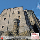
A destra della settecentesca Parrocchiale di San Pietro apostolo, si snoda la storica e ripida mulattiera che raggiunge l’imponente Sacra di San Michele monumento simbolo del Piemonte, e una delle più importanti architetture romaniche europee e mèta secolare di pellegrinaggio internazionale.
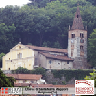
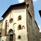
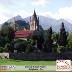
Dal complesso monastico una mulattiera in discesa attraversa la frazione San Pietro e lungo gli ampi tornanti tappe della Via Crucis, giunge a Sant’Ambrogio di Torino, il cui borgo medioevale è ben leggibile nell’intatta cinta muraria, nelle torri di avvistamento (XIII sec.) e nel Castello abbaziale (XII sec.). Di notevole pregio artistico e architettonico è la Parrocchiale di San Giovanni Vincenzo, eremita fondatore della Sacra: l’impianto interno, la cupola e la facciata sono settecenteschi su progetto del Vittone, mentre il campanile, costruito forse su precedente edifico a uso militare, presenta lo stile sobrio dell’originale romanico. Il percorso prosegue attraversando la via principale di Sant’Ambrogio sino a raggiungere il Museo del Dinamitificio Nobel: interessante esempio di architettura industriale d’inizio Novecento, ha ospitato dal 1872 al 1965 la fabbrica di esplosivi più importante d’Europa. Superato il Dinamitificio la strada selciata sale verso il centro storico di Avigliana: Porta Ferrata, Casa Beato Umberto, le case medioevali di piazzetta Santa Maria accompagnano il cammino verso il cuore medioevale della città, Piazza Conte Rosso. Uno scorcio suggestivo con l’antico pozzo, gli edifici in cotto e porticati, l’ostello per i pellegrini si apre sul Castello arduinico (X sec.): dote della Comitissa Adelaide di Susa ai Savoia, divenne avamposto delle ambizioni della dinastia sul torinese e infine smantellato dai francesi nel 1690. La Parrocchiale di San Giovanni (XIII sec.) conserva le più importanti tele cinquecentesche del pittore Defendente Ferrari; nei pressi della chiesa è inoltre possibile osservare la Torre dell’orologio: nel 1330 vi fu collocato il primo orologio pubblico del Piemonte. Tra gli edifici sacri di Avigliana si segnalano il seicentesco Santuario della Madonna dei Laghi, costruito sul luogo dove sorgeva un pilone votivo mèta di pellegrinaggio già dal XIV sec.; la Chiesa di San Pietro (XII sec.) con l’affascinante stratificazione di affreschi databili tra l’XI e il XV sec.; la Chiesa di Santa Maria Maggiore, di impianto romanico con modifiche in chiave gotica del XIV sec. Il cammino prosegue tra i vicoli medioevali del centro storico nei pressi del Palazzo del Beato Umberto, costruito in seguito a un lascito del 1347 e sede dell’antico Ospedale, in cui venivano ospitati i pellegrini che transitavano sulla Via Francigena.
- development: 16 km
- run time: 5 ore 30 minuti
- ascending drop: 235 m
- discending drop: 297 m
- difficulty: Escursionistico
- starting: Bussoleno 442 m slm
- arrival: Condove 380 m slm
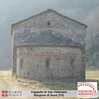
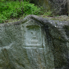
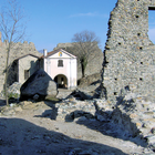
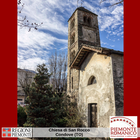
ll cammino francigeno lungo la sinistra orografica della Dora Riparia parte da Bussoleno e costeggia la linea ferroviaria, su strada asfaltata sino a raggiungere la frazione Grangia di Chianocco, passando davanti all’antica casaforte (XII sec.), interessante esempio di architettura civile romanica. Situato all’imbocco della Riserva dell’Orrido di Chianocco, il paese è composto da numerose frazioni ma il suo cuore più antico è caratterizzato dal maestoso complesso fortificato del Castello (XIII sec.) e dall’antistante Parrocchiale di San Pietro Apostolo, sorta in seguito all’alluvione che distrusse quella romanica, di cui rimane solo la suggestiva orre campanaria; nei vigneti . Si segnala anche la Cappella cimiteriale di Sant’Ippolito decorata da affreschi databili XV sec. La strada scende verso la frazione Vindrolere attraversando una zona ricca di orti, coltivi, boschi e vigneti, sino a Bruzolo: si passa accanto a un’antica fucina azionata da un sistema idraulico, una delle più complesse architetture protoindustriali della Valle di Susa insieme al Mulino ad acqua recentemente rimesso in funzione. Il castello (XIII sec.), residenza signorile delle famiglie fedeli alla corte sabauda fu sede della firma dei Trattati di Bruzolo (1610) fra il duca di Savoia e il re di Francia. Attraversato l’abitato, la strada continua in discesa imboccando a sinistra la carrozzabile che costeggia le pendici della montagna lungo la quale si sviluppa il comune di San Didero caratterizzato dal nucleo medioevale della casaforte dalle mura merlate del massiccio torrione. Il percorso prosegue in direzione di Borgone Susa dove una deviazione conduce alla suggestiva radura del Maometto con la roccia scolpita raffigurante una divinità agreste. raggiunta la frazione di San Valeriano ove sorge la cappella romanica una decorazione absidale del Cristo pantocratore (XII sec.). Un breve tratto di pista ciclabile parallelo alla SS24 porta alla località Molere, conduce alla sterrata che costeggia la montagna sino alle frazioni Grangetta e Poisatto e all’area pic-nic sul torrente Gravio. Un largo marciapiede lungo la statale conduce alle porte di Condove, uno dei centri più grandi della valle, composto da 74 borgate montane: alcune di queste presentano ricche testimonianze artistiche come la Cappella di San Bernardo al Laietto (1430), la romanica Cappella di San Rocco mentre ai piedi della dorsale rocciosa si può invece ammirare il Castrum Capriarum, detto anche Castello del Conte Verde: citato dal XIII sec. come dipendenza del monastero di San Giusto di Susa, con ruolo difensivo e residenziale. La sua strutture era probabilmente collegate alle celebri Chiuse Longobarde che videro arretrare i Longobardi colti di sorpresa da Carlo Magno.
- development: 28,5 km
- run time: 11 ore 30 minuti
- ascending drop: 1245 metri
- discending drop: 1821 metri
- difficulty: Escursionistico
- starting: Oulx 1082 m slm
- arrival: Susa 500 m slm
Oulx - Salbertrand (7,2 km)
The route continues along the tarred road. Going past the village of Gad you then follow the directions for the Sentiero dei Franchi (a mountain hike that leads to the Sacra di San Michele) up to the deviation for Salbertrand: this is home to the Gran Bosco Natural Park, one of the largest white spruce woods in Europe, and to the Colombano Romean Living Museum which includes as one of its tours a viewing of the splendid 16th century frescoes in the Parish Church of San Giovanni Battista and the Chapel of San Cristoforo in the village of Oulme.
Salbertrand - Exilles (6,2 km)
Continuing along the Sentiero dei Franchi, you reach Sapè, from which you turn to descend towards Exilles, a hamlet featuring intact Alpine architecture of stone and wood, and dominated by the impressive Fort Exilles (12th century). In the central square there is the Romanesque bell-tower and the Parish Church of San Pietro Apostolo which has a richly decorated high altar of 1681. Also the small Chapel of San Rocco, just at the exit of the town, is of interest, possibly the result of renovating an earlier building.
Exilles - Chiomonte (7,5 km)
The route continues around the Fort, partly going down the eastern access ramp, and reaches the ancient path that leads to the crossing over the Dora Riparia. In the distance, on the left, can be seen the old bridge and the new high bridge that cross the Gorges of the Dora: shortly after, the trail turns back on itself, going along the left bank of the river. This is followed by a flat section and then, descending, a picturesque area through the terraces of Avanà vines, a highly appreciated native wine recently rediscovered: today this stretch is characterised by the bold contraposition of an almost extinct civilisation with the high flyovers of the modern Frejus motorway.
Chiomonte is the next stage on the route, once the summer residence of the Bishop of Pinerolo: the old town centre is an exceptional gem of courtyards, porticoes, alleys and ancient aristocratic palazzos such as Casa Ronsil and Palazzo Levis, home to the Pinacoteca Civica (art gallery); the Chapel of Santa Caterina, formerly dedicated to John the Baptist, is all that remains of the Hierosolymitan hospital: its interiors decorated in the Baroque period, there are fragments of 14th century frescos while the outside has a decoration of blind arcades and a 13th century poly-lobed portal. The Parish Church of Santa Maria Assunta, flanked by a majestic bell-tower in Romanesque-Dauphin style, has valuable wood furnishings typical to Alpine baroque such as the choir-stalls and the pastoral seat, works by Jacques Jesse of Embrun, the main door by Eymon Lord, and the retable (altarpiece) of twisted columns on the altar of the Rosario (1682) by Cheffrey Faure. Along the main street there is a beautiful stone fountain dating back to 1544 with four jets of highly refreshing water: travellers should get supplies here for continuing their journey since there will be no other chance for quenching their thirst until Susa.
Chiomonte - Susa (7,2 km)
On leaving Chiomonte, the route runs beside the main road for about 800m along a protected path, and is then left at the signpost “Strada del Plans”, going to the left along dirt roads and trails, through meadows and woods towards the deep ravine of the Gorge della Dora, which can be glimpsed through the thick vegetation. The route is in constant descent, apart from an occasional short rise, and goes close to the cliffs of the Gorge above which, on the opposite side, can be seen the villages of Giaglione silhouetted against the sky and the Rocciamelone mountain.
At this point, having crossed the territory of Gravere, the trail gently descends into the woods, revealing here and there the paved road of the probable Via delle Gallie that leads to the incomparable entry into Susa through the elegant Augustan Arch (8BC), next to the remains of the Roman aqueduct (3rd century AD) built on the rocks of a Celtic altar. In this area there is a fountain with exceptionally cold water, even in the summer, and is an important refilling point for those taking the route towards France. A little further down stands the majestic Porta Savoia on the medieval walls to the west of the city, from where started the road towards the “Gaul lands”.
- development: 20,9 km
- run time: 7 ore
- ascending drop: 328 m
- discending drop: 384 m
- difficulty: Escursionistico
- starting: Condove 380 m slm
- arrival: Alpignano 322 m slm
Da Condove la carrozzabile arriva all’abitato di Caprie, il cui nome trae origine dal sovrastante monte Caprasio, raggiungibile con percorso escursionistico dalla frazione Celle e la grotta eremitica di San Giovanni Vincenzo, fondatore della Sacra di San Michele, e della Chiesa di Santa Maria Assunta, che presenta una cripta con affreschi del X sec. Il cammino principale prosegue sulla pista ciclabile affiancata al lungo rettilineo stradale che conduce alla frazione Novaretto: l’ottocentesca Parrocchiale dei SS. Rocco e Sebastiano offre un’interessante bicromia data dall’alternanza di bande nere e bianche, mentre internamente spicca la ricca struttura a cassettoni della navata centrale. Superate le ultime abitazioni di Novaretto, la strada diventa sterrata e costeggia la Collina della Seja. Per evitare la trafficata SS24, un facile sentiero sale alla frazione Torre del Colle di Villar Dora, costruita nel 1289 per iniziativa di Amedeo V di Savoia allo scopo di difendere l’attraversamento della Dora Riparia: su questa dorsale, in una zona boscosa sorge la Cappella di San Pancrazio, affrescata con un ciclo pittorico di fine XV sec. Quindi il percorso scende e incrocia una via secondaria che conduce al centro storico del paese, dominato dal maestoso Castello Provana: frutto dell’unione di tre caseforti più antiche, a partire dal XIII sec. fu interessato da ampliamenti e rivisitazioni in chiave neogotica; poco distante sorge anche la Parrocchiale dei SS. Vincenzo e Anastasio, parzialmente ricostruita nel Seicento, con alcuni importanti arredi e tele da ricondurre alla committenza della famiglia Provana. Proseguendo lungo la strada principale si entra in Almese: l’insediamento di epoca romana è testimoniato dal ritrovamento in località Grange Rivera di una Villa, tra le più importanti residenze romane in Piemonte. Di grande interesse storico lungo il cammino è il Ricetto di San Mauro, risalente al XIV sec. sorto per difendere il preesistente edificio monastico, successivamente il campanile fu trasformato in torre, mentre il corpo principale divenne il mastio del nuovo castello, circondato da due cinte murarie e sfruttato come ricetto. Seguendo la pista ciclabile che attraversa la frazione Milanere si prosegue su una carrozzabile poco trafficata, costeggiando le pendici del monte Musinè sino all’ingresso di Caselette: a destra, su uno sperone roccioso, svetta il complesso del Castello di Camerletto, dipendente dall’Abbazia di Novalesa e costruito tra l’XI e il XII sec. con la funzione di grangia fortificata. Sulle pendici del Musinè, invece, il Santuario di Sant’Abaco testimonia un culto locale dalle radici antiche, riferibile al martirio e sviluppatosi intorno al V o VI sec. in seguito all’opera di evangelizzazione delle popolazioni della Valle di Susa, sino ad allora legate a riti pagani. La presenza di un asse viario di epoca romana è testimoniata, come ad Almese, da una villa rustica di età imperiale (I-IV sec.), situata in località Pian tra le cascine Malpensata e Forchetto; sul promontorio su cui si è sviluppato Caselette spicca inoltre il Castello Cays, forse trecentesco, più volte interessato da ampliamenti tra il XVII e XIX sec.
Il cammino francigeno prosegue verso Torino. A valle del Castello di Camerletto, presso la SS24, una strada sterrata si inoltra nei pianeggianti campi e coltivi dell’area che fiancheggia la Dora Riparia: segnalata anche come ciclostrada, conduce con piacevole passeggiata al Ponte Vecchio di Alpignano, unendosi al percorso proveniente da Sant’Antonio di Ranverso, in direzione Collegno (tappa 4).
- development: 2,5 km
- run time: 40 minuti
- ascending drop: 0
- discending drop: 20 m
- difficulty: Turistica
- starting: Chiusa San Michele 380 m slm
- arrival: Sant'Ambrogio 360 m slm
Da Chiusa San Michele si può raggiungere Avigliana senza salire alla Sacra di S.M, seguendo l’Antica Via di Francia, che costeggia la base del monte Pirchiriano, attraversa il borgo medioevale di Sant’Ambrogio. Da qui parte anche la via ferrata Carlo Giorda che sale verso l’abbazia.
- development: 18,4 km
- run time: 6 ore
- ascending drop: 285 m
- discending drop: 356 m
- difficulty: Turistico
- starting: Avigliana 390 m slm
- arrival: Collegno 302 m slm
Raggiunta Piazza del Popolo e attraversato Corso Laghi, l’Antica Via di Francia prosegue pianeggiante tra i campi sino alla frazione Ferriera di Buttigliera Alta: oltrepassato il cavalcavia ferroviario, la strada decorre, in direzione est-ovest, parallela alla ferrovia e arriva alla Precettoria di Sant’Antonio di Ranverso. Il complesso ospedaliero sorse nel1188 per volere dell’ordine di Sant’Antonio di Vienne, allo scopo di assistere i pellegrini sulla Via Francigena e curare i malati di ergotismo (il “fuoco di Sant’Antonio”); sostenuto nei secoli dai Savoia, la sua conduzione passò all’Ordine Mauriziano, cui ancora oggi appartiene. Lo stile gotico, gli elementi in cotto alle finestre e alle chiavi di volta e la celebre facciata a ghimberghe ne fanno uno dei monumenti più suggestivi del Piemonte; all’interno, oltre al polittico di Defendente Ferrari, tra le campagne decorative databili tra l’XII e il XV sec. spicca l’opera pittorica di Giacomo Jaquerio: la Madonna in trono, le Storie di San Biagio, il ciclo della Passione.
Poco dopo la Precettoria, si prende una strada sterrata a sinistra che raggiunge la zona industriale sulla SS 25. Attraversata la statale in corrispondenza del semaforo, si segue la strada che costeggia la zona industriale fino ad un’ampia rotonda, in corrispondenza della quale si prende a sinistra la strada comunale di Rivoli, si passa sotto l’autostrada e subito dopo si svolta a destra costeggiando per circa 200 m l’autostrada. Si prende una sterrata a sinistra e dopo poco si svolta a destra, lungo la strada che decorre parallela alla ferrovia in direzione Alpignano. Si attraversa la ferrovia (sottopasso) e lasciata a sinistra il parco di Villa Govean, si giunge infine ad Alpignano, nella cui Chiesa di San Martino di Tours è conservato uno mirabile crocifisso ligneo dello scultore settecentesco Carlo Giuseppe Plura. La città fu colonia romana ed è citata nel Medioevo per la presenza di una importante domus hospitali sulla Strada di Francia, un tempo alle dipendenze dall'Abbazia di Novalesa; oggi è nota anche per l'Ecomuseo Sogno di luce, dedicato all'inventore della lampadina Alessandro Cruto.
Proseguendo lungo la ciclabile che costeggia la riva sinistra della Dora si raggiunge Pianezza: nella via principale sorge la Pieve di San Pietro (XII sec.) dalla caratteristica architettura romanica ma internamente affrescata nel Quattrocento da Jacquerio e la sua bottega; strettamente legata al percorso francigeno è la Chiesa di Santa Maria della Stella, dalla quattrocentesca e ricca decorazione ad affresco. Il nucleo fortificato del ricetto, profondamente trasformato o inglobato nel centro storico, è visibile solo in parte ma spicca ancora la medievale Torre del Ricetto, ora torre civica. Il percorso da Pianezza prosegue parrallelamente alla Dora lungo la ciclabile in direzione di Collegno; attraversate dapprima l’autostrada e poi la Dora si giunge in breve alla Certosa di Collegno.
Suggestions
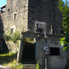 Almese
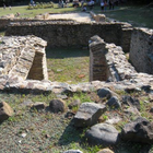 Almese
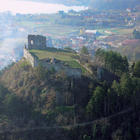 Avigliana
 Avigliana
 Avigliana
 Avigliana
 Avigliana
 Avigliana
 Avigliana
 Borgone Susa
 Borgone Susa
 Bussoleno
 Bussoleno
 Bussoleno
 Buttigliera Alta
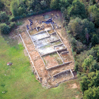 Caselette
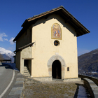 Chiomonte
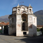 Chiusa San Michele
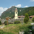 Chiusa San Michele
 Condove
 Condove
 Exilles
 Giaglione
 Giaglione
 Moncenisio
 Novalesa
 Novalesa
 Novalesa
 Novalesa
 Oulx
Oulx
 Salbertrand
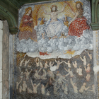 Salbertrand
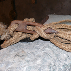 Salbertrand
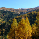 Salbertrand
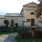 San Giorio di Susa
 Sant'Ambrogio di Torino
 Sant'Ambrogio di Torino
 Susa
Susa
 Susa
Susa
 Susa
Susa
 Susa
Susa
 Vaie
Vaie
View as a list
Services
- The Butterfly Garden B&B - Avigliana
- Tourist Office of Avigliana - Avigliana
- La Stellina - Bruzolo
- B&B Autin - Bruzolo
- Massi Hotel Valle di Susa - Bruzolo
- B&B Foresto - Bussoleno
- B&B L'Antico Borgo - Caprie
- B&B Pera Rionda - Caprie
- La Sosta Climb Café - Caprie
- Polvere di Stelle tour operator - Caprie
- Tourist Office of Cesana Torinese - Cesana Torinese
- Tourist office of Claviere - Claviere
- Cré Seren farmerhouse - Giaglione
- Chalet sul lago hotel restaurant - Moncenisio
- Polenteria La Ramasse - Moncenisio
- I Marrons - Moncenisio
- C'era una Volta farmhouse - Novalesa
- Della Posta hotel restaurant - Novalesa
- El Dorado hotel restaurant - Novalesa
- B&B La Ressia - Novalesa
- B&B Strada Antica - Novalesa
- Ristorante delle Alpi - Novalesa
- Abbadia of Oulx of Don Bosco Salesian Institute - Oulx
- Tourist office of Oulx - Oulx
- Camping Gran Bosco - Info point - Salbertrand
- Management body of the Protected Areas of the Cottian Alps - Salbertrand
- Casa Didé Location/Delivery - San Didero
- B&B Baita Evelina - San Giorio di Susa
- Cascina dei Canonici farmerhouse - Sant'Ambrogio di Torino
- The Sun B&B - Sant'Ambrogio di Torino
- Pilgrim's house at the parish - Sant'Antonino di Susa
- Former convent of San Francesco hotel - Susa
- Beato Rosaz Center of the Franciscan missionary nuns - Susa
- Diocesan Cultural Center of Susa - Susa
- Napoleon Hotel - Susa
- Susa & Stazione hotel - Susa
- Osteria della Marchesa - Susa
- Tourist office of Susa - Susa
- La locanda del Priore - Vaie
- Cascina Roland - Villar Focchiardo
